Devils Elbow to St. Louis, Missouri — U.S. Route 66
On April 30, 1926, three highway men sat in the Colonial Hotel in Springfield, Missouri, arguing over a number. The new Chicago-to-Los Angeles road was supposed to be U.S. 60, but Kentucky wanted that one. They wired Washington that they would take 66 instead. On November 11 the federal map was approved, and a road 2,448 miles long had a name. That is why Springfield calls itself the birthplace of Route 66, and why the road turns 100 this year.
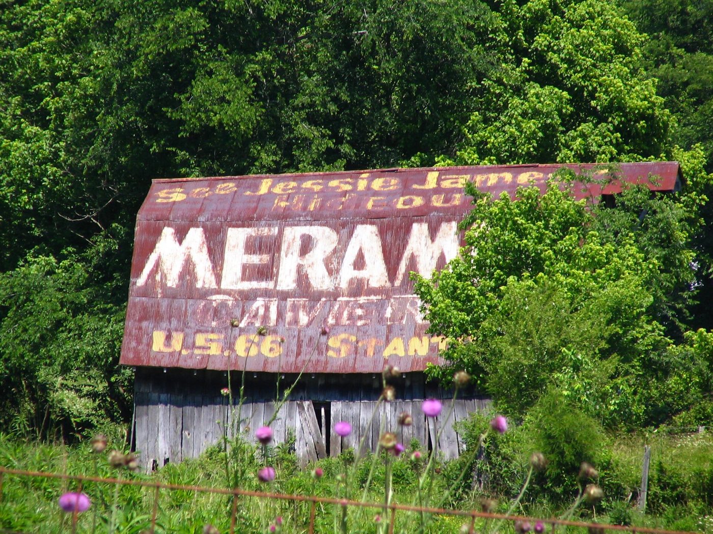
Missouri got 317 miles of it and finished paving its share in the spring of 1931. For thirty years the road carried everything: Dust Bowl families, Army convoys bound for Fort Leonard Wood, honeymooners, truckers, and station wagons full of kids reading the Meramec Caverns barns. Then, through the 1960s, Interstate 44 was built alongside it, and the traffic moved over. The old road was taken off the federal books in 1985.
The towns did not move. They are still there, a mile or two off the exits, most of them passed by tens of thousands of cars a day that never slow down. Here is a day on the slow road, west to east, with a stop for barbecue.
First Stop: Devils Elbow, Where the River Fought the Loggers
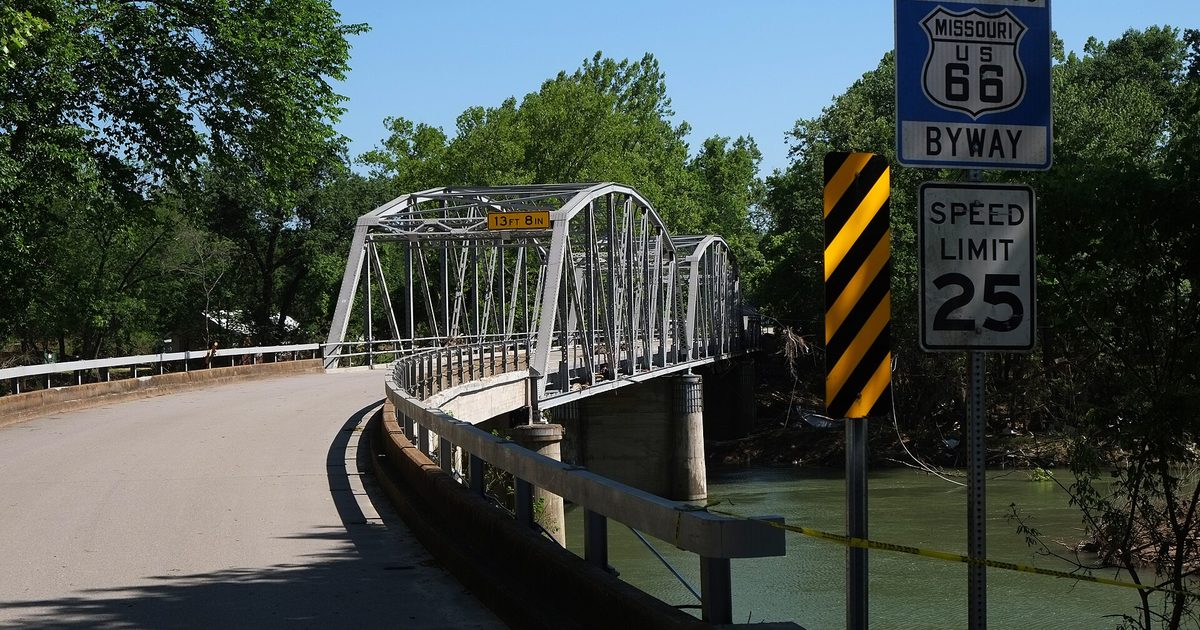
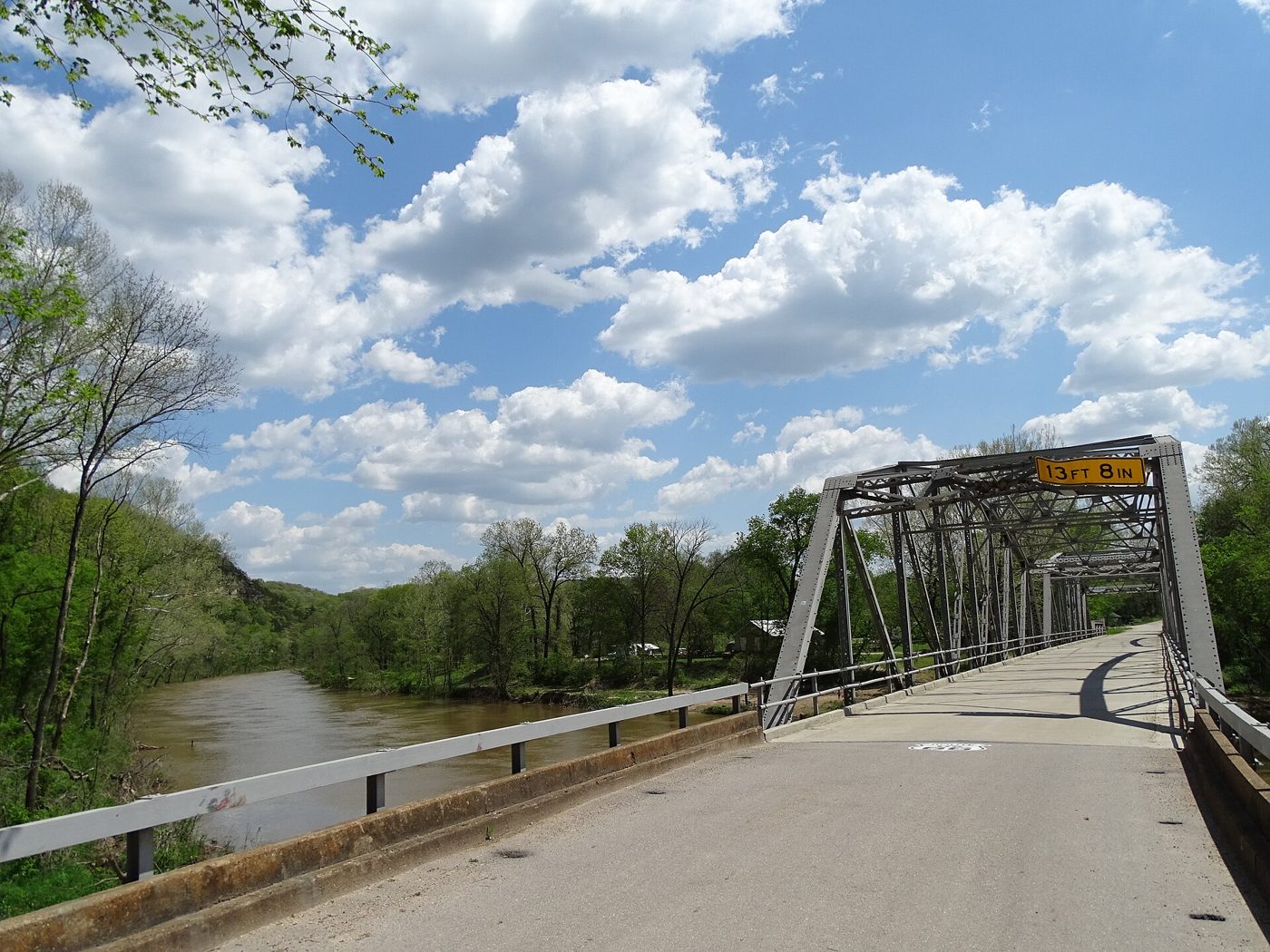
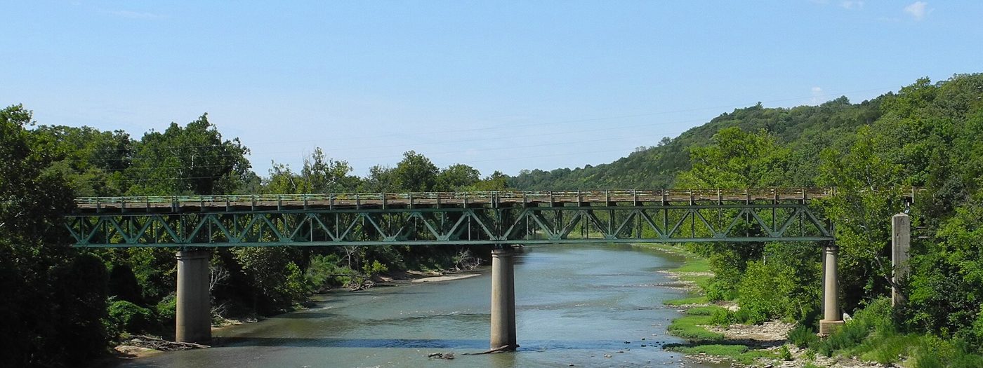
Before there was a highway there was a river problem. Lumbermen floating railroad ties down the Big Piney kept losing their rafts on one vicious bend, and they cursed it with a name that stuck. A village grew up at the Devil’s Elbow in the 1870s, St. Louis sportsmen came for the fishing, and in 1923 the state built a 589-foot steel truss bridge across the river. Three years later the gravel road over it was renumbered U.S. 66.
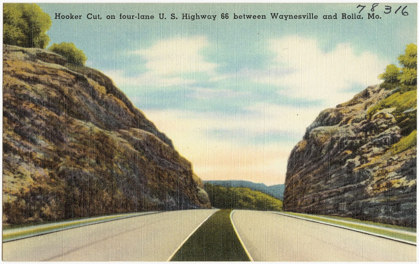
In the 1930s the State Planning Commission named the bluffs here one of the Seven Beauty Spots of Missouri. Then the war came. Fort Leonard Wood opened five miles west, and the twisting road through the village could not handle the convoys. Engineers blasted a four-lane highway straight through the ridge instead. The Hooker Cut, about 90 feet deep through solid limestone, was one of the deepest road cuts in the country when it opened, and the first four-lane stretch of Route 66 in Missouri.
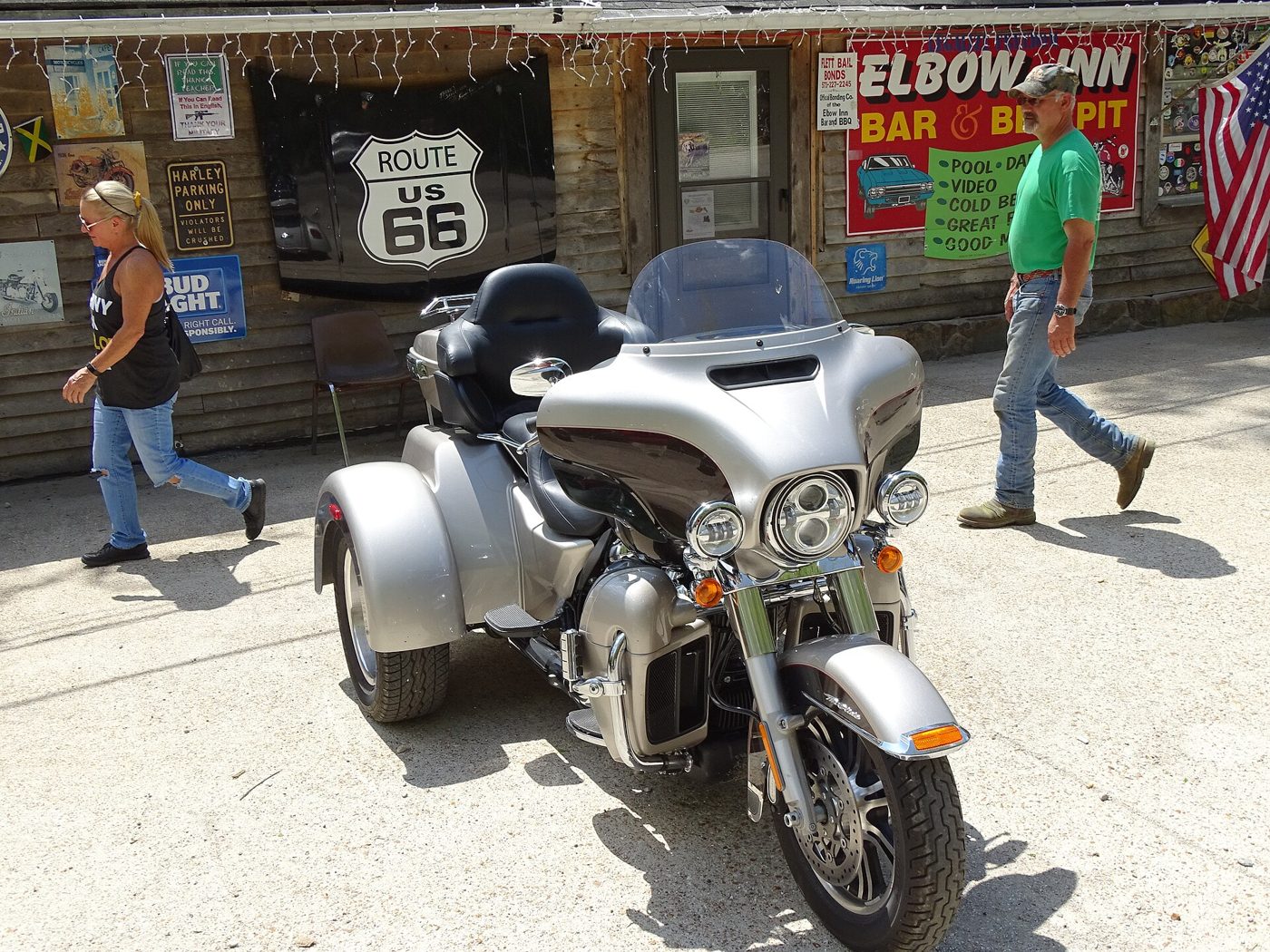
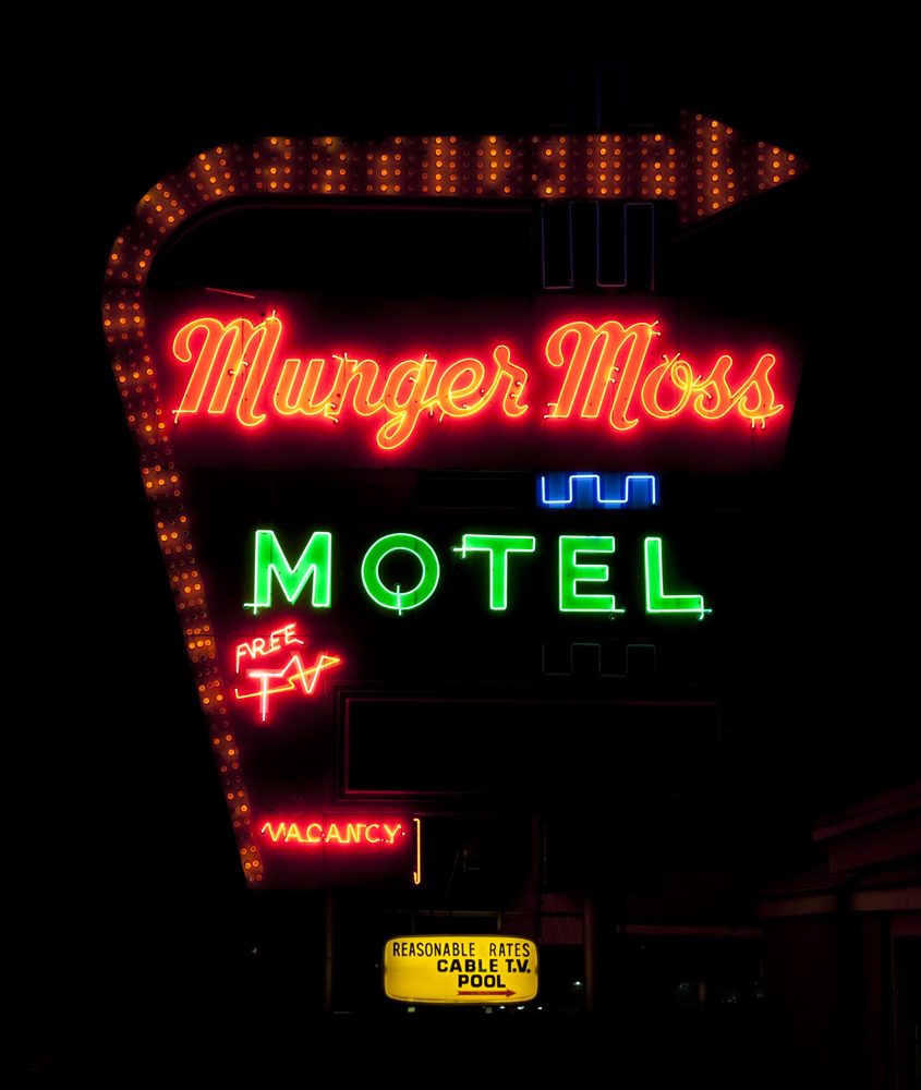
The bypass left Devils Elbow in a quiet loop off the main road, which is exactly why it survived. In 1936 Nellie Munger and Emmett Moss had built a sandwich shop at the north end of the bridge. When the traffic left after the war, so did they, to Lebanon, where they put their name on a motel whose neon sign still glows tonight. The sandwich shop became the Elbow Inn, a renowned barbecue roadhouse. In April 2017 the river came back for its elbow: floodwater rose over the bridge and reached the inn’s roof. The bridge was repaired. The inn has been closed for renovation since.
In 2017 the whole village, bridge and roadbed included, was listed on the National Register of Historic Places as the Devil’s Elbow Historic District.
66
St. James: The Forest City and the Spring That Made Iron
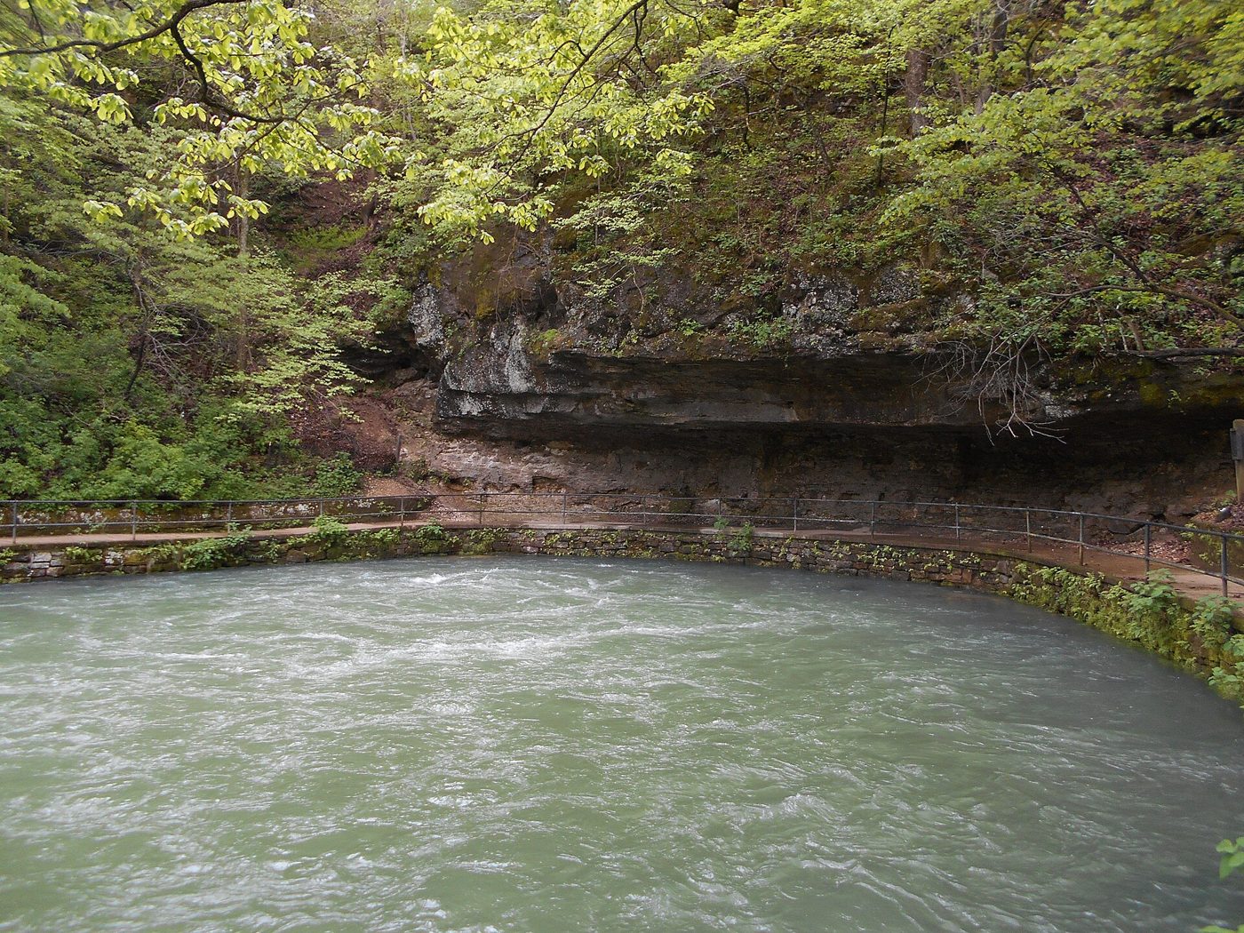
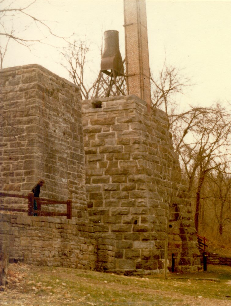
St. James was founded in 1859 by John Wood, who guessed right that the railroad was coming and laid out a shipping town for the Maramec Iron Works eight miles south. The works, started in 1826, was the first commercial ironworks west of the Mississippi. It was powered by a spring that still pours roughly a hundred million gallons a day out of the base of a bluff, and the stone furnace stack still stands beside it.
The town calls itself the Forest City of the Ozarks, and when Route 66 came through it sold the forest: cabins, trout fishing, and a run of motor courts and filling stations along the highway. Finn’s Motel on Grover Street took Route 66 travelers for decades. Out on Old Highway 66, a 1950s gas station became Route 66 Motors, and its collection of classic cars still sits by the road.
The other thing St. James sells is wine. Italian families who had left hard jobs in Chicago planted vineyards here, and in 1970 Jim and Pat Hofherr opened St. James Winery beside the highway. Their first two wines, Velvet Red and Velvet White, are still the bestsellers, and the family calls it the largest winery in Missouri, at something like 200,000 cases a year. This is the one stop on the trip where the driver orders the grape juice.
Cuba: Fifteen Walls and a Stone Motel
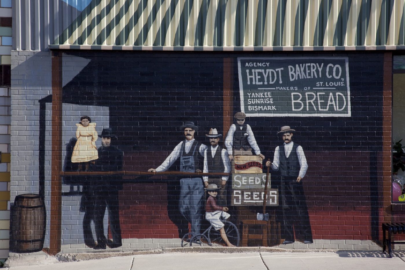
Cuba was platted in 1857 in anticipation of the railroad and named by settlers who admired the island’s fight against Spain. For a century it was a railroad and highway town, and when the interstate pulled the traffic away in the 1960s the downtown faded with it. In 1984 a group of residents formed Viva Cuba to do something about it. For years that meant flower beds. In 2001, when Peoples Bank wanted to mark its 100th birthday, Viva Cuba suggested a mural of the bank’s first cashier instead of a plaque.
They did not stop. The group set out to paint twelve murals by the town’s 150th anniversary in 2007, and that year the Missouri Legislature named Cuba the Route 66 Mural City. There are fifteen now, each with a QR code that tells its story. Amelia Earhart put her plane down in a field outside town on September 4, 1928. Harry Truman campaigned here in 1940. Bette Davis spent a night at the Southern Hotel in November 1948 and her husband chased off a photographer. The Gold Star Boys mural on West Washington Street shows the faces of six young men from around Cuba who went to the Second World War and did not come home. The Civil War panels at Main and Buchanan started as a fifteen-year-old’s Eagle Scout project; Chip Lange wrote a 60-page proposal and raised $21,000, and the artist painted him into the mural as thanks. And the Osage, whose trails became the highway, were painted by one of their own, the Osage artist Norman Akers.
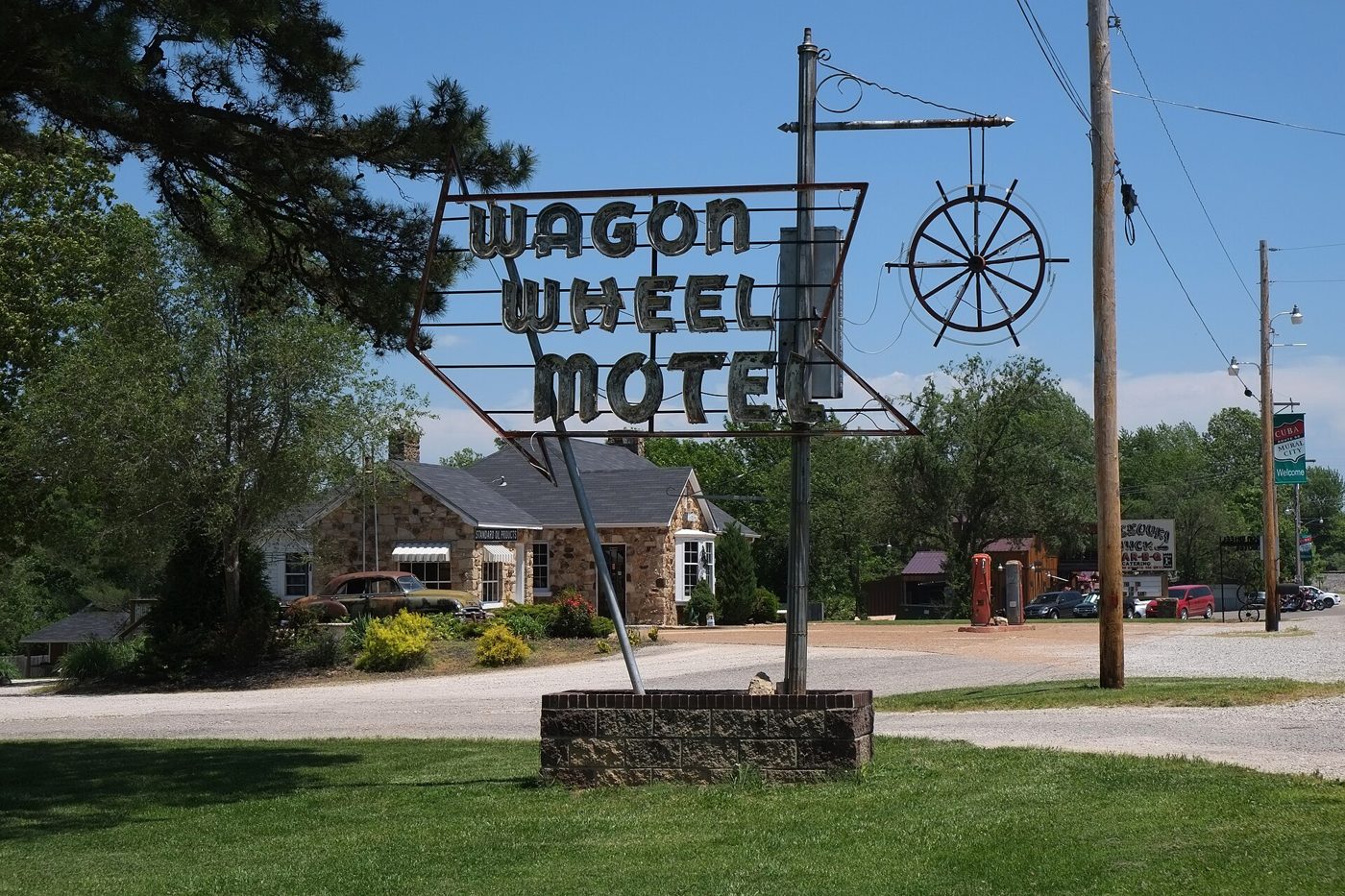
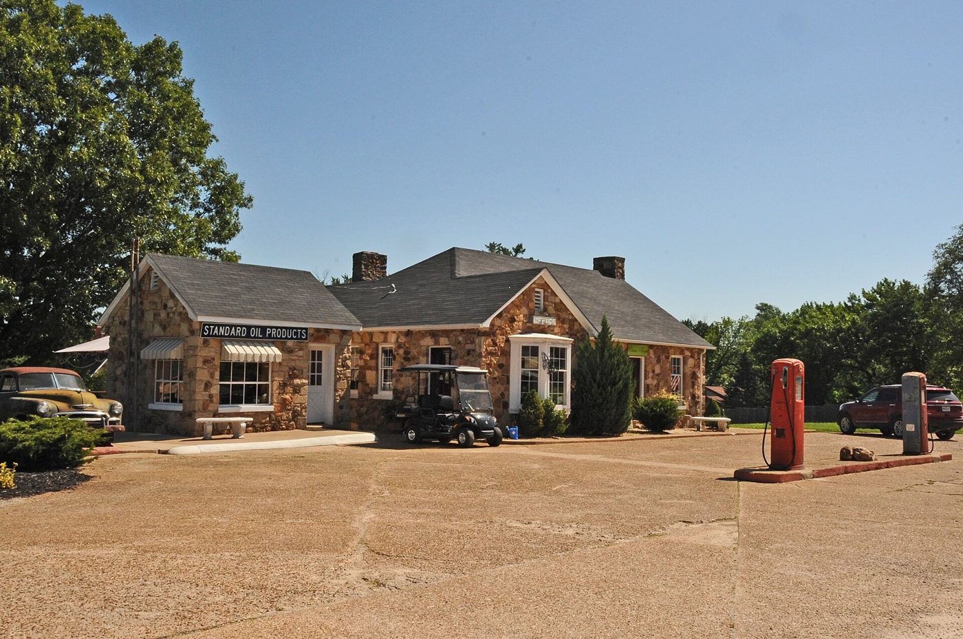
On the east side of town stands the oldest motel on Route 66 that never stopped renting rooms. Leo Friesenhan, a St. Louis stonemason, built the Wagon Wheel Cabins in 1936 out of Ozark sandstone, in a Tudor style with steep roofs and arched doorways. The 1939 AAA guide listed nine stone cottages with private baths at $2.50 to $3 a night for two and called it “one of the finest courts in the state.” John and Winifred Mathis bought it in 1947, renamed it the Wagon Wheel Motel, and Mr. Mathis designed the neon sign himself. It went on the National Register in 2003, and this past spring it changed hands again, to a Route 66 preservationist. You can still check in.
Lunch: Missouri Hick Bar-B-Q
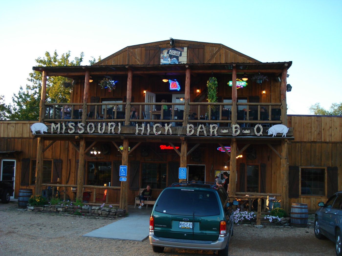
Next door to the Wagon Wheel, at 913 East Washington Street, is a two-story log building with a porch full of rocking chairs and a smoker working out back. Missouri Hick Bar-B-Q does pulled pork, brisket, turkey, chicken and, on Fridays, prime rib, with a lineup of sauces on every table. This is the kind of stop the old road was built around: a place you pull into because you can see it from the driver’s seat and smell it from the parking lot.
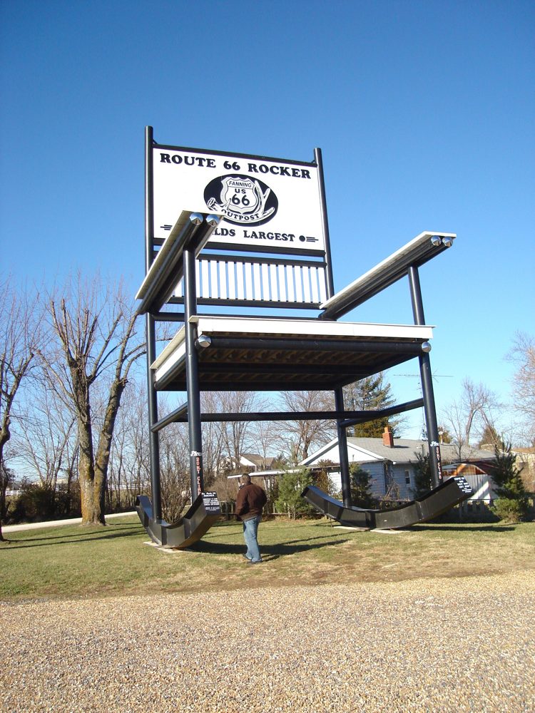
If there is room for one more stop, drive four miles west on Route ZZ to Fanning, where Danny Sanazaro put up a 42-foot steel rocking chair on April Fools’ Day 2008 to pull customers into his feed and archery store. Guinness would not certify it as the world’s largest until it was filmed actually rocking, so the welder cut it loose, the crew rocked it on camera, and he welded it back down. It held the title until a 56-foot chair went up in Casey, Illinois, in 2015. Sanazaro painted it red and renamed it the Route 66 Red Rocker, and it is still there.
66
Pacific: The Log Restaurant That Became the Town’s Front Door
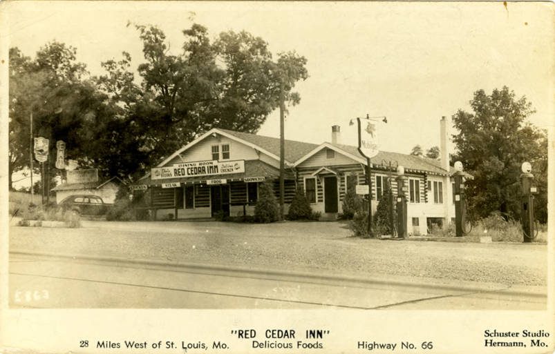
In 1934, during the Depression, brothers James and Bill Smith cut logs on their family farm and built a restaurant with them beside the highway in Pacific. They added a tavern wing the next year, and by 1940 everyone called it the Red Cedar Inn. It fed Route 66 travelers for seventy-one years. A real-photo postcard of the inn in the Newberry Library was written on March 31, 1943, by a traveler who had driven 359 miles that day at the wartime limit of 35 miles an hour, from Stratford, Missouri, to Lawrenceville, Illinois: “We ate our dinner at this inn west of St. Louis.”
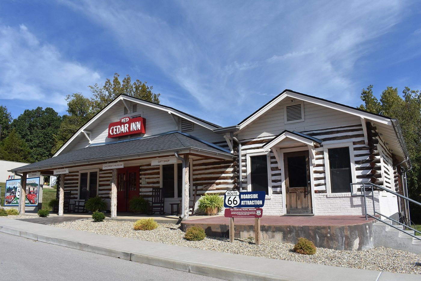
The Smith family closed it in 2005, blaming insurance costs, and for a dozen years the logs sat empty while the city and the family talked. Pacific bought the building for $290,000 in 2017, spent $2.2 million rebuilding it, and in August 2023 reopened it as the Red Cedar Inn Museum and Visitor Center. The town the interstate drives past now greets its visitors in the building that fed the old road.
Route 66 State Park: The Town That Is Not There
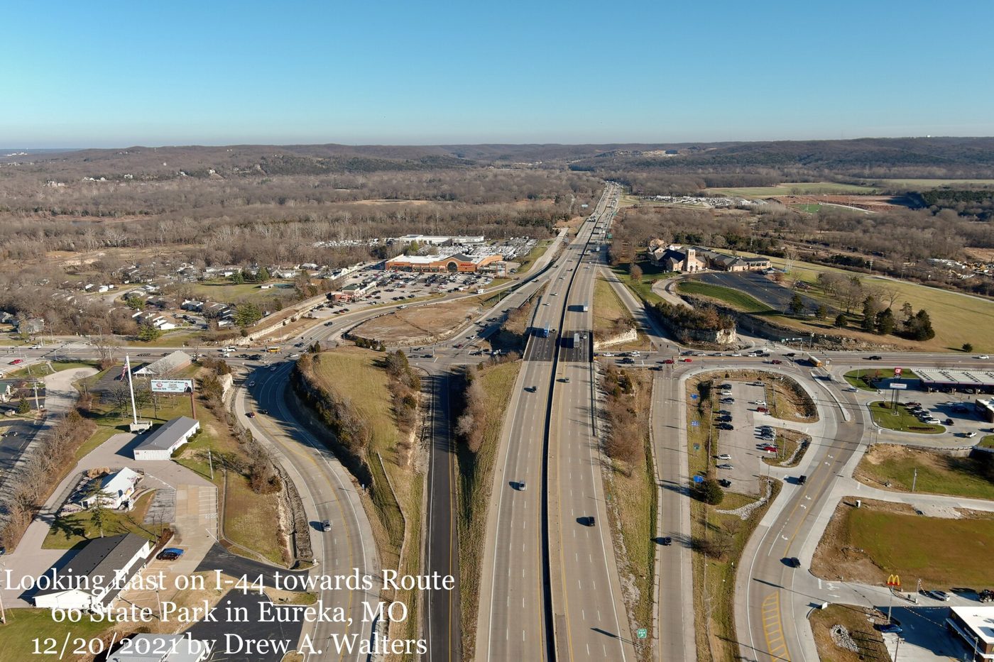
In 1925 the St. Louis Star-Times sold lots on a bend of the Meramec River, 20 feet by 100, for $67.50 and a six-month subscription. The resort it promoted became a town called Times Beach, and when Route 66 was rerouted through it in 1931 a steel bridge went up over the river and a roadhouse, the Bridgehead Inn, opened at its east end in 1935. By 1980 more than two thousand people lived there.
The streets were dirt. In the early 1970s the town hired a waste-oil hauler named Russell Bliss to spray them down for dust, four years of it for $2,400. The oil had come from a chemical plant and was laced with dioxin. In December 1982 the Meramec rose fourteen feet over flood stage and drove everyone out, and days later, on December 23, the Centers for Disease Control announced that nobody should move back. The federal government bought the whole town, 800 homes and 30 businesses, for about $37 million. Times Beach was dissolved by the governor’s order in 1985. Every building was torn down, and between 1996 and 1997 an incinerator on the site burned 265,000 tons of contaminated soil from here and two dozen other places in eastern Missouri.
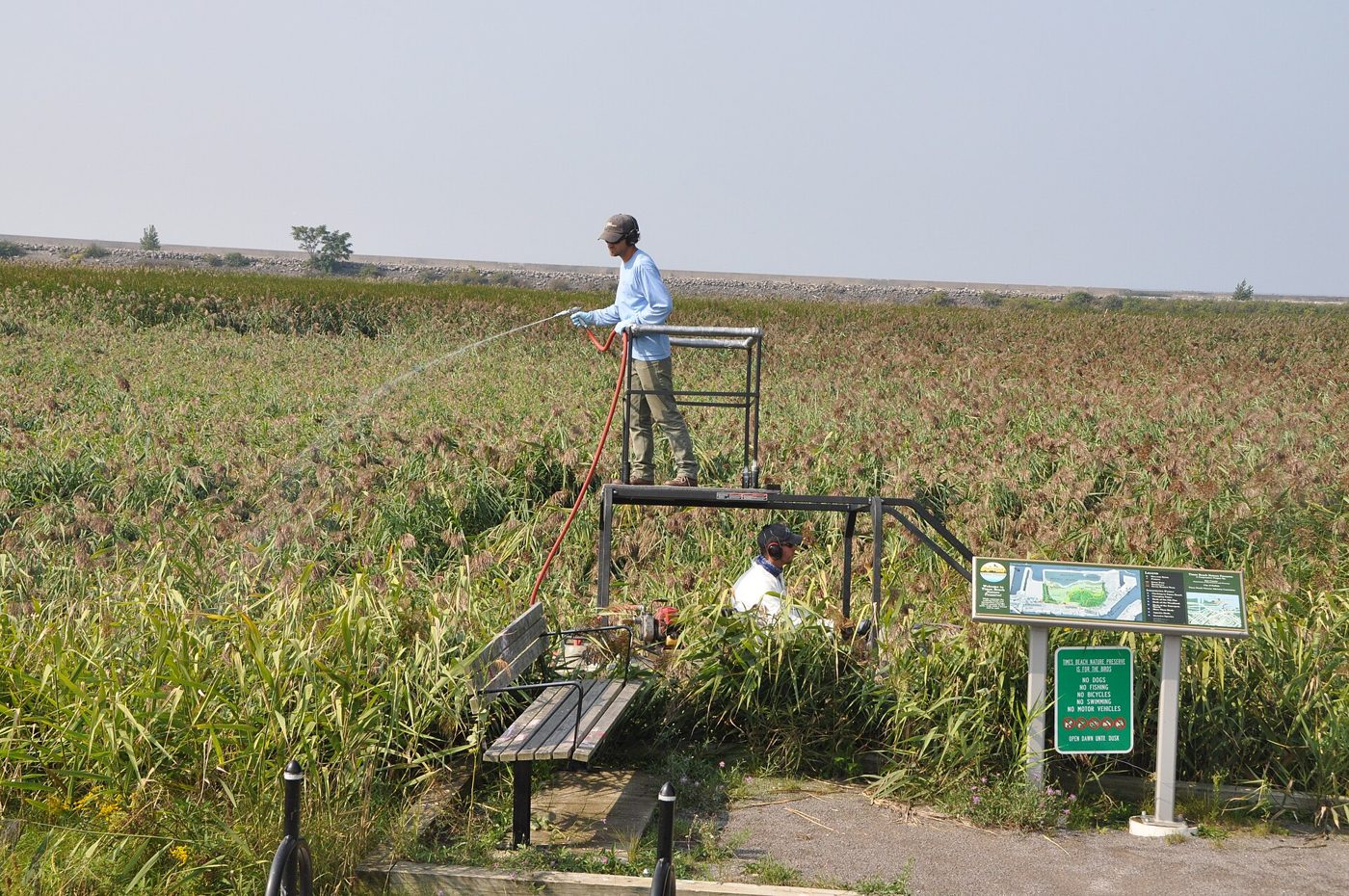
The state took the cleaned land and opened Route 66 State Park on it on September 11, 1999: 419 acres of trails and river bottom where the town used to be. The Bridgehead Inn, which had been Steiny’s Inn and then Galley West, is the visitor center, full of Route 66 signs, photographs and the story of the town. The 1931 bridge was closed in 2009 when inspectors said it could no longer carry traffic. Plans to reopen it for walkers and cyclists have been in the works ever since.
66
St. Louis: A Concrete on Chippewa
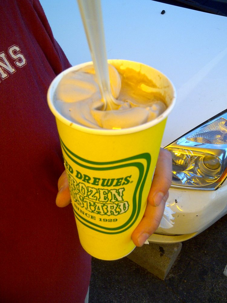
Ted Drewes Sr. learned the frozen custard trade with a traveling carnival in Florida and sold his first cone there in 1929. He came home to St. Louis and opened a stand on Natural Bridge the next year, then one on South Grand. In 1941 he built a third on Chippewa Street, because Chippewa was Route 66 and the road was full of people who had been driving all day. The Natural Bridge stand is long gone. The Chippewa one has been drawing lines on summer nights for 85 years.
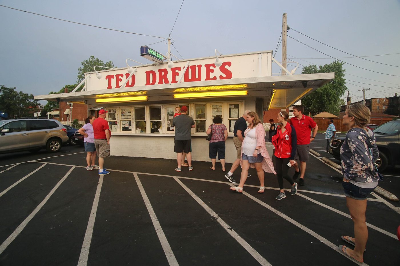
The thing to order is a concrete, custard blended so thick with whatever you ask for that the kid at the window hands it to you upside down to prove it will not fall out. It has not fallen out yet.
Last Stop: The Bridge With a Bend in It
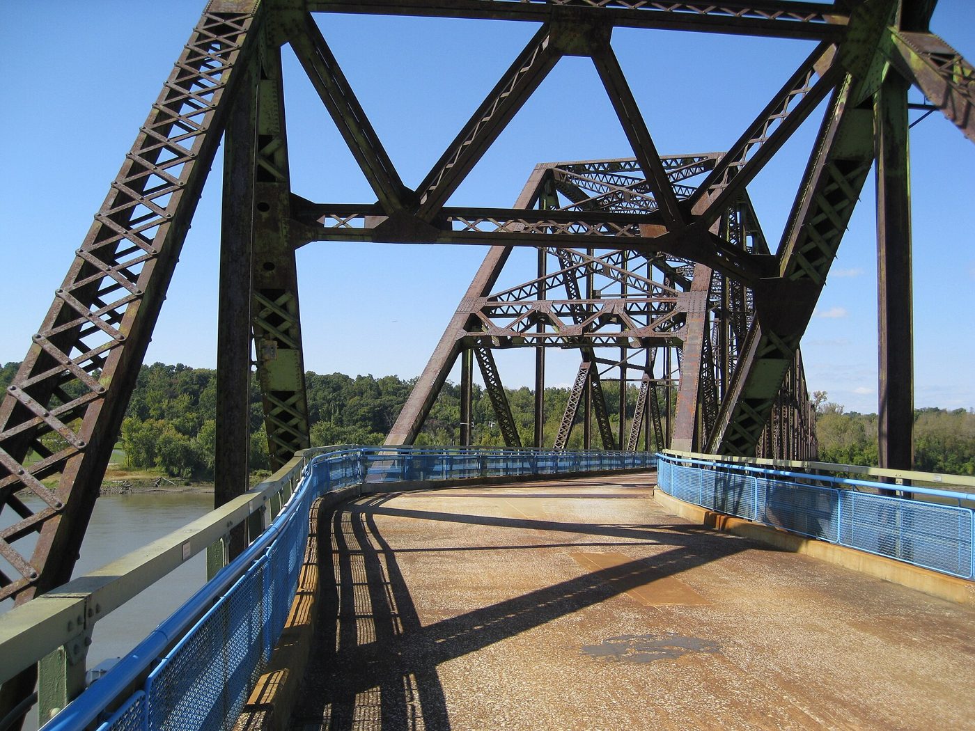
At the north edge of the city, where the Mississippi runs over a ledge of rock that gave the place its name, a private company started building a toll bridge in 1927. The plan was a straight shot across. The riverboat pilots objected: the bridge would have landed its piers next to the two castle-like water intake towers that stand in the river, right in the channel they used to thread the rocks. So the builders put a bend in the middle of the bridge, more than twenty degrees, and ran the far half at a new angle to the Illinois shore. It opened in July 1929, a mile long, at twice its budget.
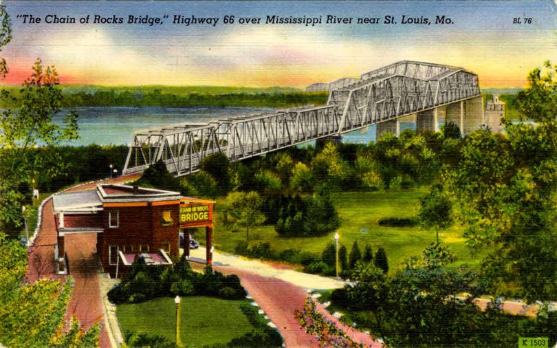
Route 66 was routed over it in 1936, and for three decades every westbound traveler who took the bypass around St. Louis paid their toll and made the turn in the middle of the river. In 1967 the Interstate 270 bridge opened 2,000 feet upstream. The old bridge closed the next year and rusted for thirty years. The Army considered blowing it up for practice. What saved it was the price of scrap steel, which fell so far that tearing it down would have lost money. In 1980 John Carpenter used it as a ruined New York bridge in Escape from New York. On June 19, 1999, it reopened to bicycles and walkers, and it has been full of them ever since.
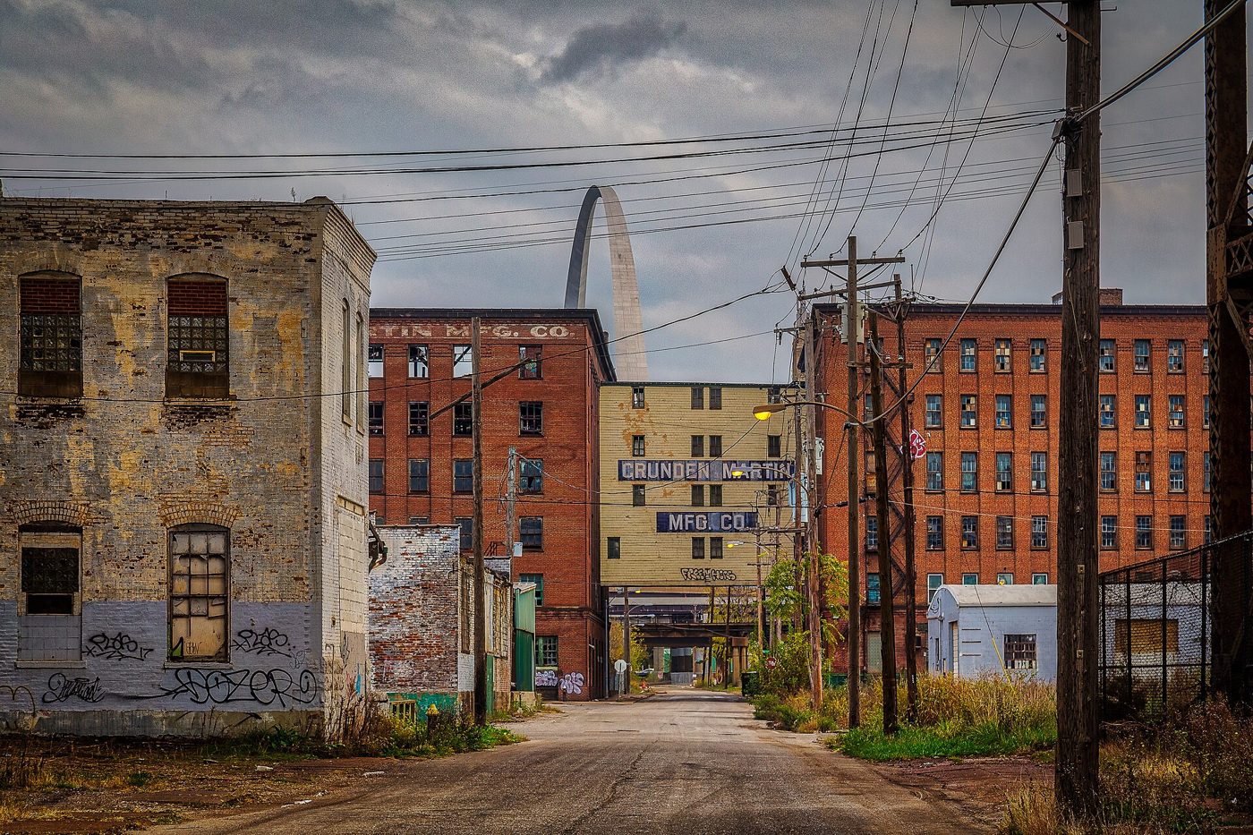
Stand at the bend and look south and you can see the Gateway Arch, which was finished in 1965, two years before the interstate bridge took the traffic away. The Arch celebrates the people who went west from here. The bridge under your feet carried a good share of them.
Still There
Every town on this drive was passed over by the interstate in the 1960s, and every one of them lost something: the motel trade, the gas stations, the cafe that fed three hundred strangers a day. What they did not lose was the road itself. It is still paved, still signed as Historic Route 66, and it still runs through the middle of town, past the stone motel and the log restaurant and the fifteen painted walls, because nobody ever bothered to tear it up.
So the next time you are on 44 and the sign says Cuba or St. James or Pacific, take the exit. The town has been waiting there the whole time, about a mile off the highway, with the sign still lit.
Same road. New stories. And a whole lot of Missouri in between.